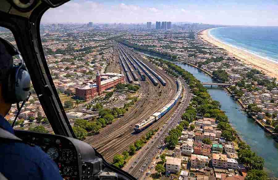
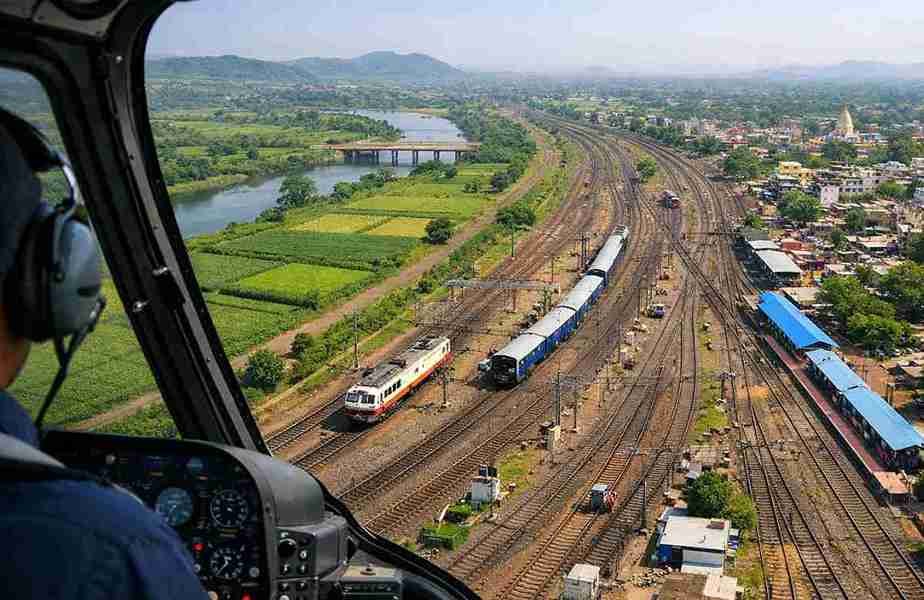
Get fast, accurate, and efficient survey coverage with Aerial Survey by Helicopter in Chennai from Hitto Trip Pvt Ltd. Our helicopter-based aerial survey service is ideal for large-area inspections, infrastructure monitoring, and time-sensitive projects where ground surveys are slow or difficult.
Chennai is a major hub for infrastructure development, highways, ports, industries, and urban expansion. A helicopter aerial survey in Chennai helps authorities, companies, and project teams get a clear aerial view for better planning and decision-making.
What is an Aerial Survey by Helicopter?
An aerial survey by helicopter involves using a helicopter to observe, inspect, and assess land or project areas from the air. It provides wide-area visibility and quick coverage, especially useful for large or complex locations.
This service is commonly used for:
- Land and site inspection
- Project progress monitoring
- Route and corridor surveys
- Industrial and urban area checks
- Emergency and disaster assessment
Aerial Survey Services Offered by Hitto Trip Pvt Ltd in Chennai
At Hitto Trip Pvt Ltd, we coordinate helicopter aerial survey operations with proper planning, safety focus, and smooth execution. Our service is designed to meet project needs efficiently and professionally.
Survey Coverage in and Around Chennai
Chennai includes coastal zones, industrial belts, highways, and dense urban areas where helicopter surveys are highly effective. Our aerial survey service supports:
- Infrastructure and construction projects
- Highway and road inspections
- Port and coastal area observation
- Industrial zone monitoring
- Urban planning and land review
Key Uses of Helicopter Aerial Survey in Chennai
Our aerial survey by helicopter in Chennai is suitable for multiple sectors, including:
- Infrastructure and road development
- Powerline and transmission inspection
- Pipeline and route assessment
- Industrial project monitoring
- Port and coastal inspections
- Government and municipal surveys
- Disaster management and emergency review
Why Choose HITTO TRIP PVT LTD for Aerial Survey in Chennai
Hitto Trip Pvt Ltd is trusted for professional helicopter coordination and reliable aerial survey planning. We focus on safety, efficiency, and accurate area coverage based on your project requirements.
Key benefits include:
- Faster survey completion
- Wide-area coverage in less time
- Suitable for urban and coastal regions
- Better aerial visibility for planning
- Efficient for urgent and large-scale projects
Areas We Serve in Chennai (Subject to Feasibility)
Hitto Trip Pvt Ltd provides aerial survey by helicopter in Chennai and surrounding regions, subject to permissions and operational feasibility:
- Chennai city
- OMR and IT corridor
- ECR coastal belt
- Sriperumbudur industrial area
- Chengalpattu
- Kanchipuram
- Tiruvallur
How to Book Aerial Survey by Helicopter in Chennai
Booking an aerial survey is simple with Hitto Trip Pvt Ltd. The process includes:
- Share survey purpose and location
- Confirm date, time, and coverage area
- Finalize flight plan and schedule
- Arrange approvals and coordination
- Complete aerial survey execution
Early booking is recommended for smooth scheduling and permissions.